Wednesday, March 20, 2013

Mt. Echo and Inspiration Point: A Two For One Hike


 This hike is located in the Angeles National Forest, directly north of the 210 at Altadena. There are two ways start this hike, the way we did it or the way everyone else recommends. We started off with some rough instruction to the trailhead and an extreme lack of direction. Our first mistake was taking direction from a disgruntled woman in her 60's. She directed us to Pleasantridge Drive and Rubio Vista Road, she said, "Oh there's a trailhead right between those houses!"

Trailhead Location:
  • Altadena,CA
  • Difficult Trailhead: Rubio Vista and Pleasantridge Drive
  • Easy Trailhead: E. Loma Alta Dr and Lake Ave


 We were none the wiser and took it. It was a fairly simple beginning for the first 1/4 mile, slight incline, typical low-lying native chaparral. We ended up bushwhacking half way there and nearly lost the trail multiple times from this trailhead. There was some serious incline with some spots of exposure. However, an hour and a half later we reached Echo Mountain. We found some pretty cool relics of the old hotel that was once up there. There was a railway that took the work out of the mountain so anyone could go stay up there. Now we have to trek up there like suckers.
So from the top of the peak of Echo Mountain you can yell at nature through a megaphone. I suppose thats why they call it Echo Mountain. Well, it's also known as Mt. Lowe because someone had a lot of money and claimed their spot as king of the hill.
Once you get to the top of Mt. Lowe, you can go back the way you came. Which if you were us, we'd have to choose to go through the overgrown half trail that got us there. If you're smart, you'll choose to go back the way everyone else comes up. This is the trail that is much more maintained. It could probably fit a small truck in most parts. So if you take the more popular trail back down, you can meet up with the trail for Inspiration Point. A quick 2 mile hike from Mt. Lowe. It's worth it while you're up there. We went mid-January and there was still quite a bit of snow and ice in the covered part of this trail. I had on regular cross trainers and did just fine. Yea sure, I did slip and slide. But nothing too bad.
This is an out and back trail. So once you get back down the mountain, remember where you parked. We realized that where we left the trail was not where we began it. So we had to cross through a neighborhood or two and jump a fence to get out.


Point B: Inspiration Point
Point A: Echo Mountain

Map at trailhead

Well marked trail.

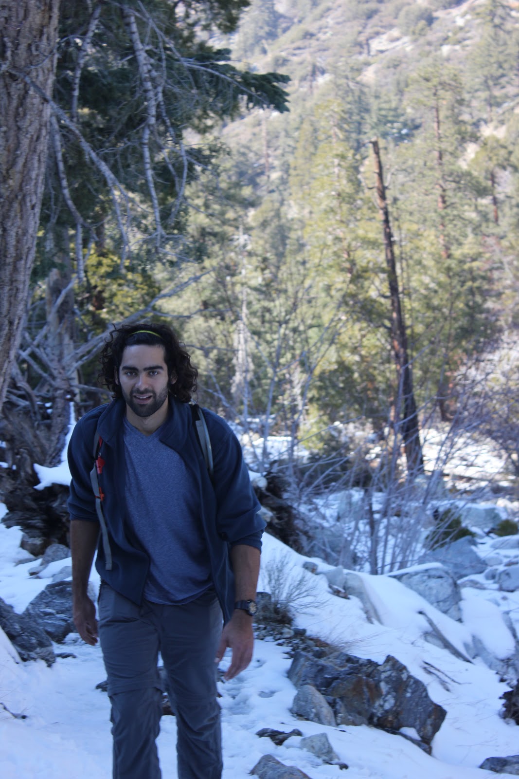
Marc on a well marked trail.

On the way to top. Yes, it was as steep as it looks.

Annoy nature with this built in megaphone.
Peace Sign Foundations
Follow the trail down to reach the trailhead for Inspiration Point. It should be  less than a quarter mile from  Mt Lowe.
Mount Lowe: There used to be a hotel up top too bad it lasted not even 5 years.
January snow/ice covered the trail enroute to Inspiration Point.


Railway leftovers

Inspiration Point: Cool little locator tubes


Saturday, February 23, 2013

Icehouse Canyon: The Trail That Lives Up To It's Name

About 1 mile in.
This trail is located in the Angeles National Forest off the 210 freeway. If you want specific directions and location of this trail, you can google directions directly to the trailhead. There are also a few dozen other hiking sites that offer mileage and difficulty ratings. We just like to skip the technicalities and jump into the hike.
So, if you are looking for a half day get away from everything urban, this will do it. We hiked this trail on the 23rd of February and was the closest to a proper winter yet. As you can tell from the cover photo, this trail was covered in snow and ice. On a clear and sunny day like it was, weather was generous enough to let us hike in shorts and light jackets. Although, at the saddle, I would of like to of had a little more to keep warm. 
Beautiful trail conditions
Icehouse trekking


Mitch in his natural habitat
Fearless leader handling the trail!


Go check this place out while it's still covered in snow. Hiking isn't just a summer activity! My girlfriend, Nicole, survived this trail. Let's just say, she does not hike. So that's what Mitch and I set out to do. We had to initiate her into the wilderness. She was less than amused when she saw what was ahead of her. However, coming down the mountain, she was all smiles. I personally take great joy in seeing others introduced into the beauty of the wilderness. That look of awe, when you just climbed 3,000ft in elevation up snowy switchbacks to overlook the entire valley. People tend to forget the troubles they went through to get there or it at least makes it all completely worth it. So before you say no right away, give it a shot. There's a lot more to hiking than walking uphill and getting dirty. There's a lot more world out there beyond street names and freeways. 

Things to know:
  • Dress warm
  • Ice/Snow can be slippery (I, as a Southern California native, tend to forget these things)
  • Bring adventure pass
  • Plan about 5 hours for this hike
Some more convincing scenery!


We made it! Look how cool we are (no pun intended).
Go check this trail out. We'll see you out there.
Love the earth and love each other.
-JoshW

Monday, November 5, 2012

Mount Hollywood: Hiking goes Hollywood

What you'll be seeing

 Mount Hollywood

The red carpet of hikes

Requires little to no prep!

What you'll need:
  • Water- 1 Liter
  • Trail Shoes
  • A buddy!   
Found on the East side of the Santa Monica Mountain Range. The geographic divider between the San Fernando Valley, Los Angeles, Santa Monica, and Glendale. A nice reminder that nature can exist beside millions of people. I call it nature because it consists of more dirt than asphalt, more native fauna than county planted palms, and enough critters to still call it wildlife. Yes, this hike just qualifies as such. It is hike. Not a daring one, you can make it one if you'd like.
Stolen from Google Maps.

Getting to Griffith Park is a fairly simple ordeal. Just west of the 5 Fwy and south of the 101, you'll find the park. There are numerous signs pointing to the Zoo, golf course, and park facilities. Just follow them. You should end up on Los Feliz. The main road that runs along the park.

Personally, I was looking for the Mount Hollywood Trail. I'm not really sure if this was THE trail because there were no markings that determined which trail was which. However, which ever way you chose led up to the same overlook and peak. Follow the above map and you should see a couple trail heads.

We took off from the parking lot after making a turn towards the "Merry Go Round" sign off of Los Feliz. For the life of us, there was nothing noting which street we were on. If you keep going north, you'll run into the LA Zoo. Not that it's a particularly bad thing, you've gone too far. Turn around and head up the hill!

Once you get onto the trail you'll notice it's hard to miss the direction it's headed. It's wide enough to drive up. Then you notice it was once paved over with asphalt. Hmm. Don't worry this still qualifies as a hike and not a walk.

Nicole adjusting to the outdoors
Now, about maybe a mile up the trail, we noticed a ladder. A well put together utility ladder. I don't know who it was intended to be used by, but we did. This climb was very worth it. Just have a little bit more confidence than you do fear, and you should be just fine.


One way ladder!
Once to the top, you're standing under a high voltage power line structure. You know it's high voltage from the nice "hmmmmm" that it gives off. I'm sure it's also giving off some super power giving radiation as well. So try not to sleep under the thing. Unless you want some funky lookin' offspring.

Anywho, we marched on up the narrow clear cut trail. It was fairly steep and full of loose dirt so watch your step. Keep climbing up and you'll reach the large trail again. You'll emerge from the climb looking up at a bridge. It's a pretty cool sight.

ZAP! ZAP!
Climb up there for ShortCut #2
We got a little curious and ventured up to the base of the bridge. Well almost the base of the bridge. Seeing the most direct path up this mountain, we took it. This was shortcut #2. We scrambled up the little dirt path until we reached a thin yellow utility rope that was tied to a steel pipe jutting from the ground. I don't know why I trusted this rope that could of been frayed up top but hey it worked. We pulled ourselves directly under the bridge.


What a view. Immediately we understood the crowds that would come through to take pictures of the panoramic views. Amazing. You could see Los Angeles, Santa Monica, the Pacific Ocean and onward. What a perfect Sunset.


We stuck around for a while, just admiring our beautiful city. It always looks better when looking in.


Took some pics, chit chatted with the fellow hikers, and hiked back down in the dark. If you're careful, you can easily go back through the two shortcuts we took. Just mind your footing, and they won't have to name the trail after you!


This is a fairly easy trail with some exploring between turns. Half a liter of water should do, one liter should be more than enough. So bring it!


Obligatory Handstand Pic
See yah guys out there!
JoshW

Friday, May 4, 2012

The Bros Guide to Pacific Poison Oak.

What has leaves of three, green and sometimes red, and will make you want to run naked through a room full of rakes?

 Give up?

PACIFIC POISON OAK.

I'm writing about this today because I believe it has affected each and every one of us in one way or another- personally and very privately. If you've spent any amount of time in the lush valleys of Southern California, you may already be familiar with this devil plant. In hopes of preventing any further encounters with this plant, this article might help those confused with it's appearance and effects.

I'm not going to get ridiculously indepth with the genus and species name of the plants, I'm not going to explain why or how 15-34% of the population are immune until repeated exposures. I'm not going to explain how the urushiol interacts with the dermis layer of the skin to cause contact dermatitis and a more severe possible anaphalaxis.

I'm going to offer quick specific tips on avoiding this awful plant and enjoy the rest of your time outdoors!
  • ARRRRGHHH...What the heck does this stuff look like!?
It's important to note where you're going to find these plants. It's called Pacific Poison Oak for a reason. It's specifically found in the Pacific Coast. It's also fair to state that Poison Ivy DOES NOT grow on the West coast.

Study these pictures well! Know your enemy. 

The "poison" in the Poison Oak is an oil called urushiol that irritates the skin and causes you to get a rash. This rash is barely comparable to a dozen or so mosquito bites. Itching is an understatement. It's the feeling that your skin doesn't belong on you! In more severe cases, blistering of the skin is a possibility, in that case, take great care to prevent infection if the skin should tear.
No two plants are exactly the same.
 Notice the bundles of three.
 Notice the rounded curves to the leaves.
Notice the spine running down the middle of the leaves and forward sweeping veins.
Notice the size
- about three leaves fit in the palm of your hand.
Notice the color
-Bright Green = Summer
-Red/Oily Red= Fall
Notice location
-Short shrubs/low to the ground
-Unless in vine form
-Mix with other vegetation such as chaparral and other dense areas of growth.


All parts of the plant have potential to cause an allergic reaction. Even after 2 years the oils are still active.

This is a Poison oak plant in the Summer or Fall?

FALL!

Look at this vine, looks like a morning glory plant or some Tarzan swinging rope vine.
WRONG.


 Although it is considered a shrub it may present itself as a vine. So be careful where you wrap your arms around when climbing a tree or finding a hand hold on a 30ft sandstone face!


 Final Quick Tips
  • Should you come in contact with the poison oak plant, wash your skin with soap and cold water to remove the oils. Follow the soap and water with a water and rubbing alcohol mixture a 1:1 ration will do the trick.
  • What about my clothes? Wash your clothes, boots, and whatever else you used outdoors! They can all carry the oils. Sneaky.
  • Also, for any reason- DO NOT SMOKE the plant. It is extremely irritating to the lungs and will cause pulmonary edema- internal drowning- death! Don't Die!
Go Be Stoked and Do Not Fear the Oak. Respect it!

Sage Ranch: Simi Valley's Hidden Gem


Just when we thought we'd exhausted all other wilderness and unknown terrain in the San Fernando Valley there was Sage Ranch. One week ago, Kim did some digital exploration on Google Maps and stumbled on this beauty. A few hurried phone calls after work, we set out for a drive down some crazy turns and steep grades. A few times we uttered, "what the...where did we end up?" but we stayed committed and before we knew it we had already entered this gem of a park.
Technically this park is located directly between the San Fernando and Simi Valleys laying directly on the Ventura-LA County line. The entrance to this park lies on Woolsey Canyon Rd and Black Canyon Road (Google it). What is usually dry, dusty terrain in the Summer, is covered in lush blooming sage, chaparral, and natural grass in Spring. Within the first minute you'll notice the large sandstone, a dominant feature that adds to the potential of this park.

This is a beautiful park that is very accessible to any one ready to get some sun! Come stoked with a curious and adventurous attitude and prepare to have a great time.
Some more local fauna blooming, adding to the beauty of this desert landscape.
Entering the park we also noticed a nice little feature that definitely surprised Kim and I. Campgrounds. Quite a few campgrounds. All shaded with charcoal grills that were ready to
 use, except for a few that were locked. Although, it is important to note that there is this sign. "Group Camping Only", well I sure don't plan on doing any one man trips. Looks like I'm in the clear, right? Ha. I'm not recommending anything.


Yes, this park has a trail. Yes, we recommend all hikers to stay on the trail but the vegetation is hearty and low maintenance. As we are all aspiring climbers and mountaineers, we look forward to absailing these boulders. Belays will be set in place and we will all come home- hopefully with a few bumps and bruises.


You can get a wonderful view of the surroundings by scrambling up a few boulders. Watch your step and you'll be fine!


There are also countless caves, nooks, and crannies to explore in this park. Go, dig deep in this park. 
My few words of warning:
  • Bring water! 1-2 liters should be just fine for a few hours here. There is access to water fountains at camp.
  • Watch for snakes. Signs are posted everywhere, don't be aggressive in your exploration, respect the land!
  • Keep an eye out for Poison Oak! Leaves of three let them be. Seriously.
  • Don't litter. Don't Graffiti. Don't break Glass.
 Go check this place out, don't be bummed if you make a wrong turn. Enjoy the ride, you're going somewhere new!

Monday, April 30, 2012

Re-Igniting the Dirtbag

As the few of you may have noticed, there hasn't been an update to this blog in months. We haven't forgotten about the blog, it's come up in conversation nearly every time we've met. I'd use the excuse of Winter to blame on our lack of things to write about but we live in Southern California. There hasn't been much of a Winter in the first place. We have squeezed out a few trips and tried out a few new things but it's been almost a chore to accomplish. We'll be covering Carrizo Plains in the next post but for now I wanted to talk about re-igniting the dirtbag in all of us.

Stuck in classrooms, behind desks, waiting call-backs, repaying loans, moving out, moving back in, balancing relationships, 12hour shifts, and just looking for direction have all slowly snuffed out that spirit of Summer. That limitless feeling to the days, one adventure after another, faded with the season. As I drove 5 hours home, from Mammoth after spending a full day on the mountain, I continued my binge on The Dirtbag Diaries. This blog, this podcast, was a slap in the face. A few guys, down on their luck, professionally, turned to blogging to pass the time. They are Oregonians after my own heart. They've turned their passion for outdoors and adventure outwards. All the excuses, all the things stopping us from going out and getting dirty, they discuss. They're not sponsored athletes going out and telling us to just "Do It". They bring meaning to the adventure in their lives. Listening to all of this, I started to realize:
I'm getting comfortable.

Not in the car I was sitting, not the bed I was going home to. I was getting comfortable with life. Sleeping in, spending weekends eating out, finding bars to go to, have all eased me into this state. I've become uncomfortable with the idea of change. The idea to just go out and get lost, get scraped up. Not saying that I don't enjoy any of these things. It's all we've been able to squeeze out of our weekends, afternoons, and conflicting schedules. So with Summer coming up, we've been planning some trips up and down the coast. Flying east and driving west. Getting stuck, climbing out. Carvin' asphalt.
Here's to the upcoming season with all of you!
Here's to
A Stoked Summer.

Coming Soon: Carrizo Plains National Monument Review and Tribute to the BLM

Wednesday, October 5, 2011

When someone asks you to go 1 mile, go 26.

Well, this long awaited update is not quite the update you expected. I’m going back a few months to one of the most spontaneous and testing experiences I’ve put myself through willingly. It wouldn’t be fair at all to say I put myself through this alone, the man who might just be crazier than I am for letting this happen, Mitch Ramos was right there alongside me. 

You’re probably wondering, ok, enough with the hinting and dodging the details, what are you talking about? I’m sure you all have your moments of genius; whether it be in the shower, in the car, on your pillow right before you fall asleep, wherever it may be, ours turned out to be on Marc Capule’s couch. A night like any other, we’d been cycling through the channels trying to entertain ourselves before we gave into the night. Mitch and I strike up the usual conversation about when our next run is going to be, you see we’ve been training for an imaginary marathon for the past six months waiting for the right time to go for the gold. Funny thing is, we’ve already planted the seeds for this night months ago. We both agree on how nice of a night it is, how nice it would be to go for a jog.

 Well, tonight was the night we decided to run to the beach.

Before you jump on our plan, no, we don’t live on or near the coast. One cannot simply walk to the beach. Between us and our destination lie 26.6 miles of asphalt. Personally, the farthest I’ve ever ran in a single session was 11 miles and Mitch has completed a half-marathon once upon a time. We pretend to understand what 26.6 miles feels like. Who needs to register with 5,000 of your closest strangers to knock out a run?

Our departure time is nearly 1am. We begin our journey in sandals, jeans, and about two in. Don’t let the involvement of our B.A.C. skew your judgment on the night; this was going to happen regardless. It’s nearly 1.5 miles to our first stop for supplies. We use my house as a launching point. Packing our packs with as much water as we can hold, throw in a towel for good measure, we switch on our headlamps, and head into the darkness.  Among the many observations made that night, 1:30 am is an extremely peaceful time of the night.

We stick to major streets, Rinaldi to Tampa is our first stretch, our feet fresh and our lungs are capable. No issues here. Luckily for the both of us, a 7-11 convenience store is on that very corner. We decide that now is the time to stock up on any necessities and celebratory materials. As for necessities, I was beginning to experience some chaffing. As any experienced runner can vouch for me, when one chafes all one does is think chafe thoughts. So I picked up a tub of Vaseline. Mitch picks up a bottle of wine for the predicted victorious ending. We saw two separate unrelated items. The cashier looked at us with those fearful eyes of his. Here were two men in shorter than short-shorts, purchasing a bottle of wine and Vaseline. He used the “it’s past 2am” excuse to cut our purchase in half. We say our goodbyes to the fellow customers that were ever curious to where the rest of the marathon runners were. With chaffing solved, we head south on Tampa. This is fairly uneventful; we pass familiar landmarks that encourage us along the way. Luckily for us, this is mostly downhill that merges into fairly level terrain.

After trekking nearly 9 miles in 2-ish hours, we reach our first minor accomplishment. There we find ourselves looking at the 101 freeway and Ventura Blvd. This meant two things; first, there was no going back from here. Second, we’re not even half way done. Physically, we were beginning to feel our feet; our bodies were beginning to realize what we had committed to. Mentally, we knew we had to keep our pace to avoid the summer heat and the threat of traffic. Our next stretch followed Ventura Blvd north until we reached Topanga Canyon.

Here began our push, Ventura follows a fairly straight path but gains and loses elevation at a whim. It is here we also began to acknowledge we did not have a gearing system to haul ourselves up these hills. The world was still at peace around 3:30am, busy restaurants and shops were closed up, giving us the street to ourselves. Mitch and I start motivating each other with quick bursts of speech between breaths. “ONLY 2 MORE *breathe-breathe* MILES ‘TILL TOPANGA!”…”SURE BEATS SLEEPIN’ DOESN’T IT?”…”WHY ARE WE DOING THIS AGAIN?” Our third and final stop before the grand stretch of Topanga Canyon was a 76 Station at Topanga Cyn and Ventura.
Exhaustion was beginning to catch up to us. Our solution to these physical feelings? Ice cream, candy, power bars, and Gatorade helped suppress any urges to pass out. This last stretch was truly going to be a battle of mind and body. For those unfamiliar with Topanga Canyon, it winds all the way through the Santa Monica Mountain range until it spits you out on the coast. This is roughly 12 miles in itself. After a 20 minute rest stop to stretch out, we hit the pavement.

Topanga turns into a nice stretch of residential neighborhoods, quiet with ample sidewalk space to run side by side. By now, the sun is slowly making it’s appearance. Nearing, 4 am we have run straight into the dawn.  After about 30 minutes on Topanga, we cross Mulhulland Drive; the only importance to this location is that this is where our run turns into a climb. As we cross into Topanga Canyon State park, we observe the mile marker which states windy roads the next 11 miles. We ease our pace, line up single file, and march on. Running single file was important due to the fact there was no shoulder to run on. Luckily, it was still early enough where normal people were still in their beds.
Maybe it was delirium or it was finally the adrenaline kicking in, but the sunrise over the San Fernando Valley was absolutely beautiful. Our goal was to get to the beach before sunrise, but this was something much better.  We stopped to catch our breath, or nearly just stop and look for our breath. It’s nearing 5am. This is a crucial hour for us. About 3 miles into the state park, our stride is cut in half, our muscles are in full rebellion, and a new thought is emerging in both of our minds.

“Throw out your thumb.”

As traffic picks up, the idea seems more and more plausible.

“THROW OUT YOUR THUMB”, my mind screams. The idea seems all too good.

I noticed Mitch has been a little quiet; I turn just to make sure he hasn’t fallen off the road somewhere.
He threw out his thumb. I bust out laughing and immediately follow. Two good looking twenty year old guys, covered in sweat, with thumbs out. Who wouldn’t want to give us a ride? Turns out, a lot of people wouldn’t. For nearly an hour, we stumble through the canyon with our thumbs outstretched. Our feet have had enough. The sun is up, traffic is flowing. We need to get to that beach quick. Just nearly after an hour, a silver truck answers our call for a ride. Thomas, a younger man who has picked up hitch-hikers before, graciously invites us into his truck.

“You’re not going to kill me, right?” Were his first words to us.

“No, that’s not our style.” I replied jokingly.

We introduce ourselves and get on moving. Turns out Tom was a really nice guy, he was a fellow believer. Maybe it was my creepy wooden cross necklace or maybe our predicament that we’d set off on a run like this, but he started talking to us about church and sharing past experiences. I couldn’t help but have a ridiculous smile as we sailed through that canyon. It was just over 15 minutes of driving. We emerge through the canyon, with the beach right in front of us. Tom pulls over, we give our heartiest thank-you’s and step out on the coast. We made it. Nearly 6 and a half hours later, we made it. We were truly exhausted. After we dipped our feet into the cold pacific, we throw out a blanket and pass-out. 

Well, after waking from our nap, we scoured the coast for some food. Turns out, there’s no food for miles either way. We make the call. Luckily, Sanam was awake at 8:30 in the morning and ready to come get us. Another big thank you to a fellow bro. Our journey ends at a worthy destination, Kyoto Sushi.

So, next time you have the urge to do something that sounds beyond reason, go for it. Maybe, you won’t make it all the way, or it won’t end the way you set out for it to, but you’ll accomplish something and have another story to tell.
Here's our route.

Next, we’re running to New York City.
See yah out there.

Here's our video we put together on the fly: