Thursday, June 27, 2013

Mt. Baldy and the SuperMoon: A Midnight Hike

The Crew.
June 23, 2013. This happened to be the annual Super Moon, where the moon is at it's closest and brightest point to the Earth. With all this lunar illumination, we were afforded the opportunity to hike the tallest point in Los Angeles county at midnight. How else could you better bring in the Summer Solstice? I suppose a cold brew and a hot jacuzzi but we were in for a different kind of night. Marc, Sanam, and myself decided it would make for a fine Saturday night to make our way to the summit. This is a 5-to-6 hour hike that spans 11 miles and makes a gain of 4,000ft in elevation from the trail head.
We started at 9pm starting at the Manker Flats parking lot. It was already dark out with a faint glow from the Super Moon appearing from the south ridge of the San Bernadino Mountain Range. The three of us committed to the trail and made our way up the paved road until it gave way to a series of long drawn out fire road switch backs. The fire road is a supply line to the Top of the Notch Restaurant, a full fledged restaurant that hosts live music, full bar, and a respectable menu. That being said about the supply line, we did have to give the right of way to a 20 year old F-250 that came barreling down the road. We nodded to him in his headlights, he nodded back. Onto the notch.
The fire road began to glow from the intense reflection of the moon, our headlamps were rarely necessary. From the lot it took just over an hour to reach the Top Notch Restaurant and we were not disappointed.  It was a little past 10pm and the restaurant was hustling with a middle aged group of outdoors men looking to impress their dates for the evening. This wasn't too difficult as the Top Notch provided a gorgeous view of the city lights a few thousand feet down while a guitarist and bongo player provided the background music from their stage.
We stayed to take in the atmosphere over a pitcher of beer, which we will come to regret in the near future, but for now there was nothing better. Over this pitcher of beer we debated back and forth whether we would be content just hanging out at the bar and calling it a night and trekking back down. We all went back and forth on the idea but settled on the idea that we came up here to summit this peak and thats what we were going to do. So we found the bottom of our pitcher, payed our tab, and marched up the mountain.
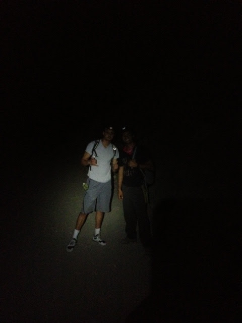
We opted to pass on the switchbacks and take the gravel path straight up the slope. With the warm of the IPA burning off, we began to realize how steep this slope was. Nearly a third up the slope, we turned our steady pace into a pattern of step-step-breathe-step-step-breathe. We were still guided by the Super Moon's intense light and appreciated every second of it. While we trudged up the gravel, we would individually catch a shooting star or two. This distracted us from the slight breeze that was picking up. Reaching the top of the gravel slope, it levels out, leading you into the series of backbones that really distinguish this trail from others. With a slight breeze and restricted visibility, the backbones were something to be cautious of.  A sheer drop on both sides would mean a tumble of nearly 1,000ft down the Baldy ridge. This would be a rather inconvenient set back for both the tumbler and his acquaintances.
Edging past the backbones, we rounded the last ridge that brought Mt. San Antonio(Baldy), into sight. Nearly there. On our final approach to the summit, we passed a group of three hikers coming down from the summit, all roughly the same age as us, all with the same ambition of the night. We made small conversation with them as if it were reassuring that we weren't the only ones committed to such a venture. We carried on up. The last approach up to the summit is nearly a climb rather than a hike. It took nearly 40 minutes to get to the top. With the wind picking up, I began to feel the cold. I had underestimated the weather and began to feel the cold. I donned the beanie and thermal that I packed and hoped my short pants covered legs would warm up. We made our way onto the crest of the summit and realized we had made it.
What a sight. It was a little past midnight when we reached the summit. First thing we noticed was the slew of tents on top of the summit. I feel like it kind of took away from the romance of being on top of a mountain in the middle of the night with nothing but the moon light but hey, we all have to share this too. I took a few pictures, attempting to capture the moon's intensity but was sure they did not do it justice. We spent a few celebratory minutes on the peak, taking in all 10,069 feet of it. Now it was time to get down this mountain before sunrise.
Coming down the mountain was rather uneventful compared to the past 3 hours climbing it. We took the Mt. Baldy trail down, in efforts to pass the round about way the fire road took us. This trail makes up for the distance by providing a steep elevation decline through a series of switchbacks and boulder hoping down. We had started getting tired around 2am, nearing two-thirds down the trail, we were getting impatient. Our resting breaks became more and more frequent, breaks for both our physical and mental side. We were ready for bed. Our time was nearing 6 hours on the trail. At about 3:40am, we reached the fire road leaving us nearly .7 miles left to the car. Our spirits were awoken again and we hustled down the pavement to our car. My jokes about leaving the keys on the summit weren't nearly as funny as I thought they would be at 4am.
We made it in the car, I started the engine, and within 5 minutes my company had given into the morning and began their snooze. I was envious. However, this provided me some rehearsal time for karaoke. An hour later, we made it back home. I was proud of ourselves for the 11 miles we put under our belt that night and the -maybe- once in a lifetime sights we saw that night.
Hope you can try this out one night. It's not as crazy as it sounds, just give it a try during the day first.

Hanging onto the ski lift looking down

Head Lamp Selfie.

Wednesday, March 20, 2013

Mt. Echo and Inspiration Point: A Two For One Hike


 This hike is located in the Angeles National Forest, directly north of the 210 at Altadena. There are two ways start this hike, the way we did it or the way everyone else recommends. We started off with some rough instruction to the trailhead and an extreme lack of direction. Our first mistake was taking direction from a disgruntled woman in her 60's. She directed us to Pleasantridge Drive and Rubio Vista Road, she said, "Oh there's a trailhead right between those houses!"

Trailhead Location:
  • Altadena,CA
  • Difficult Trailhead: Rubio Vista and Pleasantridge Drive
  • Easy Trailhead: E. Loma Alta Dr and Lake Ave


 We were none the wiser and took it. It was a fairly simple beginning for the first 1/4 mile, slight incline, typical low-lying native chaparral. We ended up bushwhacking half way there and nearly lost the trail multiple times from this trailhead. There was some serious incline with some spots of exposure. However, an hour and a half later we reached Echo Mountain. We found some pretty cool relics of the old hotel that was once up there. There was a railway that took the work out of the mountain so anyone could go stay up there. Now we have to trek up there like suckers.
So from the top of the peak of Echo Mountain you can yell at nature through a megaphone. I suppose thats why they call it Echo Mountain. Well, it's also known as Mt. Lowe because someone had a lot of money and claimed their spot as king of the hill.
Once you get to the top of Mt. Lowe, you can go back the way you came. Which if you were us, we'd have to choose to go through the overgrown half trail that got us there. If you're smart, you'll choose to go back the way everyone else comes up. This is the trail that is much more maintained. It could probably fit a small truck in most parts. So if you take the more popular trail back down, you can meet up with the trail for Inspiration Point. A quick 2 mile hike from Mt. Lowe. It's worth it while you're up there. We went mid-January and there was still quite a bit of snow and ice in the covered part of this trail. I had on regular cross trainers and did just fine. Yea sure, I did slip and slide. But nothing too bad.
This is an out and back trail. So once you get back down the mountain, remember where you parked. We realized that where we left the trail was not where we began it. So we had to cross through a neighborhood or two and jump a fence to get out.


Point B: Inspiration Point
Point A: Echo Mountain

Map at trailhead

Well marked trail.

Marc on a well marked trail.

On the way to top. Yes, it was as steep as it looks.

Annoy nature with this built in megaphone.
Peace Sign Foundations
Follow the trail down to reach the trailhead for Inspiration Point. It should be  less than a quarter mile from  Mt Lowe.
Mount Lowe: There used to be a hotel up top too bad it lasted not even 5 years.
January snow/ice covered the trail enroute to Inspiration Point.


Railway leftovers

Inspiration Point: Cool little locator tubes


Saturday, February 23, 2013

Icehouse Canyon: The Trail That Lives Up To It's Name

About 1 mile in.
This trail is located in the Angeles National Forest off the 210 freeway. If you want specific directions and location of this trail, you can google directions directly to the trailhead. There are also a few dozen other hiking sites that offer mileage and difficulty ratings. We just like to skip the technicalities and jump into the hike.
So, if you are looking for a half day get away from everything urban, this will do it. We hiked this trail on the 23rd of February and was the closest to a proper winter yet. As you can tell from the cover photo, this trail was covered in snow and ice. On a clear and sunny day like it was, weather was generous enough to let us hike in shorts and light jackets. Although, at the saddle, I would of like to of had a little more to keep warm. 
Beautiful trail conditions
Icehouse trekking


Mitch in his natural habitat
Fearless leader handling the trail!


Go check this place out while it's still covered in snow. Hiking isn't just a summer activity! My girlfriend, Nicole, survived this trail. Let's just say, she does not hike. So that's what Mitch and I set out to do. We had to initiate her into the wilderness. She was less than amused when she saw what was ahead of her. However, coming down the mountain, she was all smiles. I personally take great joy in seeing others introduced into the beauty of the wilderness. That look of awe, when you just climbed 3,000ft in elevation up snowy switchbacks to overlook the entire valley. People tend to forget the troubles they went through to get there or it at least makes it all completely worth it. So before you say no right away, give it a shot. There's a lot more to hiking than walking uphill and getting dirty. There's a lot more world out there beyond street names and freeways. 

Things to know:
  • Dress warm
  • Ice/Snow can be slippery (I, as a Southern California native, tend to forget these things)
  • Bring adventure pass
  • Plan about 5 hours for this hike
Some more convincing scenery!


We made it! Look how cool we are (no pun intended).
Go check this trail out. We'll see you out there.
Love the earth and love each other.
-JoshW

Monday, November 5, 2012

Mount Hollywood: Hiking goes Hollywood

What you'll be seeing

 Mount Hollywood

The red carpet of hikes

Requires little to no prep!

What you'll need:
  • Water- 1 Liter
  • Trail Shoes
  • A buddy!   
Found on the East side of the Santa Monica Mountain Range. The geographic divider between the San Fernando Valley, Los Angeles, Santa Monica, and Glendale. A nice reminder that nature can exist beside millions of people. I call it nature because it consists of more dirt than asphalt, more native fauna than county planted palms, and enough critters to still call it wildlife. Yes, this hike just qualifies as such. It is hike. Not a daring one, you can make it one if you'd like.
Stolen from Google Maps.

Getting to Griffith Park is a fairly simple ordeal. Just west of the 5 Fwy and south of the 101, you'll find the park. There are numerous signs pointing to the Zoo, golf course, and park facilities. Just follow them. You should end up on Los Feliz. The main road that runs along the park.

Personally, I was looking for the Mount Hollywood Trail. I'm not really sure if this was THE trail because there were no markings that determined which trail was which. However, which ever way you chose led up to the same overlook and peak. Follow the above map and you should see a couple trail heads.

We took off from the parking lot after making a turn towards the "Merry Go Round" sign off of Los Feliz. For the life of us, there was nothing noting which street we were on. If you keep going north, you'll run into the LA Zoo. Not that it's a particularly bad thing, you've gone too far. Turn around and head up the hill!

Once you get onto the trail you'll notice it's hard to miss the direction it's headed. It's wide enough to drive up. Then you notice it was once paved over with asphalt. Hmm. Don't worry this still qualifies as a hike and not a walk.

Nicole adjusting to the outdoors
Now, about maybe a mile up the trail, we noticed a ladder. A well put together utility ladder. I don't know who it was intended to be used by, but we did. This climb was very worth it. Just have a little bit more confidence than you do fear, and you should be just fine.


One way ladder!
Once to the top, you're standing under a high voltage power line structure. You know it's high voltage from the nice "hmmmmm" that it gives off. I'm sure it's also giving off some super power giving radiation as well. So try not to sleep under the thing. Unless you want some funky lookin' offspring.

Anywho, we marched on up the narrow clear cut trail. It was fairly steep and full of loose dirt so watch your step. Keep climbing up and you'll reach the large trail again. You'll emerge from the climb looking up at a bridge. It's a pretty cool sight.

ZAP! ZAP!
Climb up there for ShortCut #2
We got a little curious and ventured up to the base of the bridge. Well almost the base of the bridge. Seeing the most direct path up this mountain, we took it. This was shortcut #2. We scrambled up the little dirt path until we reached a thin yellow utility rope that was tied to a steel pipe jutting from the ground. I don't know why I trusted this rope that could of been frayed up top but hey it worked. We pulled ourselves directly under the bridge.


What a view. Immediately we understood the crowds that would come through to take pictures of the panoramic views. Amazing. You could see Los Angeles, Santa Monica, the Pacific Ocean and onward. What a perfect Sunset.


We stuck around for a while, just admiring our beautiful city. It always looks better when looking in.


Took some pics, chit chatted with the fellow hikers, and hiked back down in the dark. If you're careful, you can easily go back through the two shortcuts we took. Just mind your footing, and they won't have to name the trail after you!


This is a fairly easy trail with some exploring between turns. Half a liter of water should do, one liter should be more than enough. So bring it!


Obligatory Handstand Pic
See yah guys out there!
JoshW

Friday, May 4, 2012

The Bros Guide to Pacific Poison Oak.

What has leaves of three, green and sometimes red, and will make you want to run naked through a room full of rakes?

 Give up?

PACIFIC POISON OAK.

I'm writing about this today because I believe it has affected each and every one of us in one way or another- personally and very privately. If you've spent any amount of time in the lush valleys of Southern California, you may already be familiar with this devil plant. In hopes of preventing any further encounters with this plant, this article might help those confused with it's appearance and effects.

I'm not going to get ridiculously indepth with the genus and species name of the plants, I'm not going to explain why or how 15-34% of the population are immune until repeated exposures. I'm not going to explain how the urushiol interacts with the dermis layer of the skin to cause contact dermatitis and a more severe possible anaphalaxis.

I'm going to offer quick specific tips on avoiding this awful plant and enjoy the rest of your time outdoors!
  • ARRRRGHHH...What the heck does this stuff look like!?
It's important to note where you're going to find these plants. It's called Pacific Poison Oak for a reason. It's specifically found in the Pacific Coast. It's also fair to state that Poison Ivy DOES NOT grow on the West coast.

Study these pictures well! Know your enemy. 

The "poison" in the Poison Oak is an oil called urushiol that irritates the skin and causes you to get a rash. This rash is barely comparable to a dozen or so mosquito bites. Itching is an understatement. It's the feeling that your skin doesn't belong on you! In more severe cases, blistering of the skin is a possibility, in that case, take great care to prevent infection if the skin should tear.
No two plants are exactly the same.
 Notice the bundles of three.
 Notice the rounded curves to the leaves.
Notice the spine running down the middle of the leaves and forward sweeping veins.
Notice the size
- about three leaves fit in the palm of your hand.
Notice the color
-Bright Green = Summer
-Red/Oily Red= Fall
Notice location
-Short shrubs/low to the ground
-Unless in vine form
-Mix with other vegetation such as chaparral and other dense areas of growth.


All parts of the plant have potential to cause an allergic reaction. Even after 2 years the oils are still active.

This is a Poison oak plant in the Summer or Fall?

FALL!

Look at this vine, looks like a morning glory plant or some Tarzan swinging rope vine.
WRONG.


 Although it is considered a shrub it may present itself as a vine. So be careful where you wrap your arms around when climbing a tree or finding a hand hold on a 30ft sandstone face!


 Final Quick Tips
  • Should you come in contact with the poison oak plant, wash your skin with soap and cold water to remove the oils. Follow the soap and water with a water and rubbing alcohol mixture a 1:1 ration will do the trick.
  • What about my clothes? Wash your clothes, boots, and whatever else you used outdoors! They can all carry the oils. Sneaky.
  • Also, for any reason- DO NOT SMOKE the plant. It is extremely irritating to the lungs and will cause pulmonary edema- internal drowning- death! Don't Die!
Go Be Stoked and Do Not Fear the Oak. Respect it!

Sage Ranch: Simi Valley's Hidden Gem


Just when we thought we'd exhausted all other wilderness and unknown terrain in the San Fernando Valley there was Sage Ranch. One week ago, Kim did some digital exploration on Google Maps and stumbled on this beauty. A few hurried phone calls after work, we set out for a drive down some crazy turns and steep grades. A few times we uttered, "what the...where did we end up?" but we stayed committed and before we knew it we had already entered this gem of a park.
Technically this park is located directly between the San Fernando and Simi Valleys laying directly on the Ventura-LA County line. The entrance to this park lies on Woolsey Canyon Rd and Black Canyon Road (Google it). What is usually dry, dusty terrain in the Summer, is covered in lush blooming sage, chaparral, and natural grass in Spring. Within the first minute you'll notice the large sandstone, a dominant feature that adds to the potential of this park.

This is a beautiful park that is very accessible to any one ready to get some sun! Come stoked with a curious and adventurous attitude and prepare to have a great time.
Some more local fauna blooming, adding to the beauty of this desert landscape.
Entering the park we also noticed a nice little feature that definitely surprised Kim and I. Campgrounds. Quite a few campgrounds. All shaded with charcoal grills that were ready to
 use, except for a few that were locked. Although, it is important to note that there is this sign. "Group Camping Only", well I sure don't plan on doing any one man trips. Looks like I'm in the clear, right? Ha. I'm not recommending anything.


Yes, this park has a trail. Yes, we recommend all hikers to stay on the trail but the vegetation is hearty and low maintenance. As we are all aspiring climbers and mountaineers, we look forward to absailing these boulders. Belays will be set in place and we will all come home- hopefully with a few bumps and bruises.


You can get a wonderful view of the surroundings by scrambling up a few boulders. Watch your step and you'll be fine!


There are also countless caves, nooks, and crannies to explore in this park. Go, dig deep in this park. 
My few words of warning:
  • Bring water! 1-2 liters should be just fine for a few hours here. There is access to water fountains at camp.
  • Watch for snakes. Signs are posted everywhere, don't be aggressive in your exploration, respect the land!
  • Keep an eye out for Poison Oak! Leaves of three let them be. Seriously.
  • Don't litter. Don't Graffiti. Don't break Glass.
 Go check this place out, don't be bummed if you make a wrong turn. Enjoy the ride, you're going somewhere new!