Showing posts with label california. Show all posts

Wednesday, March 20, 2013

Mt. Echo and Inspiration Point: A Two For One Hike


 This hike is located in the Angeles National Forest, directly north of the 210 at Altadena. There are two ways start this hike, the way we did it or the way everyone else recommends. We started off with some rough instruction to the trailhead and an extreme lack of direction. Our first mistake was taking direction from a disgruntled woman in her 60's. She directed us to Pleasantridge Drive and Rubio Vista Road, she said, "Oh there's a trailhead right between those houses!"

Trailhead Location:
  • Altadena,CA
  • Difficult Trailhead: Rubio Vista and Pleasantridge Drive
  • Easy Trailhead: E. Loma Alta Dr and Lake Ave


 We were none the wiser and took it. It was a fairly simple beginning for the first 1/4 mile, slight incline, typical low-lying native chaparral. We ended up bushwhacking half way there and nearly lost the trail multiple times from this trailhead. There was some serious incline with some spots of exposure. However, an hour and a half later we reached Echo Mountain. We found some pretty cool relics of the old hotel that was once up there. There was a railway that took the work out of the mountain so anyone could go stay up there. Now we have to trek up there like suckers.
So from the top of the peak of Echo Mountain you can yell at nature through a megaphone. I suppose thats why they call it Echo Mountain. Well, it's also known as Mt. Lowe because someone had a lot of money and claimed their spot as king of the hill.
Once you get to the top of Mt. Lowe, you can go back the way you came. Which if you were us, we'd have to choose to go through the overgrown half trail that got us there. If you're smart, you'll choose to go back the way everyone else comes up. This is the trail that is much more maintained. It could probably fit a small truck in most parts. So if you take the more popular trail back down, you can meet up with the trail for Inspiration Point. A quick 2 mile hike from Mt. Lowe. It's worth it while you're up there. We went mid-January and there was still quite a bit of snow and ice in the covered part of this trail. I had on regular cross trainers and did just fine. Yea sure, I did slip and slide. But nothing too bad.
This is an out and back trail. So once you get back down the mountain, remember where you parked. We realized that where we left the trail was not where we began it. So we had to cross through a neighborhood or two and jump a fence to get out.


Point B: Inspiration Point
Point A: Echo Mountain

Map at trailhead

Well marked trail.

Marc on a well marked trail.

On the way to top. Yes, it was as steep as it looks.

Annoy nature with this built in megaphone.
Peace Sign Foundations
Follow the trail down to reach the trailhead for Inspiration Point. It should be  less than a quarter mile from  Mt Lowe.
Mount Lowe: There used to be a hotel up top too bad it lasted not even 5 years.
January snow/ice covered the trail enroute to Inspiration Point.


Railway leftovers

Inspiration Point: Cool little locator tubes


Saturday, February 23, 2013

Icehouse Canyon: The Trail That Lives Up To It's Name

About 1 mile in.
This trail is located in the Angeles National Forest off the 210 freeway. If you want specific directions and location of this trail, you can google directions directly to the trailhead. There are also a few dozen other hiking sites that offer mileage and difficulty ratings. We just like to skip the technicalities and jump into the hike.
So, if you are looking for a half day get away from everything urban, this will do it. We hiked this trail on the 23rd of February and was the closest to a proper winter yet. As you can tell from the cover photo, this trail was covered in snow and ice. On a clear and sunny day like it was, weather was generous enough to let us hike in shorts and light jackets. Although, at the saddle, I would of like to of had a little more to keep warm. 
Beautiful trail conditions
Icehouse trekking


Mitch in his natural habitat
Fearless leader handling the trail!


Go check this place out while it's still covered in snow. Hiking isn't just a summer activity! My girlfriend, Nicole, survived this trail. Let's just say, she does not hike. So that's what Mitch and I set out to do. We had to initiate her into the wilderness. She was less than amused when she saw what was ahead of her. However, coming down the mountain, she was all smiles. I personally take great joy in seeing others introduced into the beauty of the wilderness. That look of awe, when you just climbed 3,000ft in elevation up snowy switchbacks to overlook the entire valley. People tend to forget the troubles they went through to get there or it at least makes it all completely worth it. So before you say no right away, give it a shot. There's a lot more to hiking than walking uphill and getting dirty. There's a lot more world out there beyond street names and freeways. 

Things to know:
  • Dress warm
  • Ice/Snow can be slippery (I, as a Southern California native, tend to forget these things)
  • Bring adventure pass
  • Plan about 5 hours for this hike
Some more convincing scenery!


We made it! Look how cool we are (no pun intended).
Go check this trail out. We'll see you out there.
Love the earth and love each other.
-JoshW

Monday, November 5, 2012

Mount Hollywood: Hiking goes Hollywood

What you'll be seeing

 Mount Hollywood

The red carpet of hikes

Requires little to no prep!

What you'll need:
  • Water- 1 Liter
  • Trail Shoes
  • A buddy!   
Found on the East side of the Santa Monica Mountain Range. The geographic divider between the San Fernando Valley, Los Angeles, Santa Monica, and Glendale. A nice reminder that nature can exist beside millions of people. I call it nature because it consists of more dirt than asphalt, more native fauna than county planted palms, and enough critters to still call it wildlife. Yes, this hike just qualifies as such. It is hike. Not a daring one, you can make it one if you'd like.
Stolen from Google Maps.

Getting to Griffith Park is a fairly simple ordeal. Just west of the 5 Fwy and south of the 101, you'll find the park. There are numerous signs pointing to the Zoo, golf course, and park facilities. Just follow them. You should end up on Los Feliz. The main road that runs along the park.

Personally, I was looking for the Mount Hollywood Trail. I'm not really sure if this was THE trail because there were no markings that determined which trail was which. However, which ever way you chose led up to the same overlook and peak. Follow the above map and you should see a couple trail heads.

We took off from the parking lot after making a turn towards the "Merry Go Round" sign off of Los Feliz. For the life of us, there was nothing noting which street we were on. If you keep going north, you'll run into the LA Zoo. Not that it's a particularly bad thing, you've gone too far. Turn around and head up the hill!

Once you get onto the trail you'll notice it's hard to miss the direction it's headed. It's wide enough to drive up. Then you notice it was once paved over with asphalt. Hmm. Don't worry this still qualifies as a hike and not a walk.

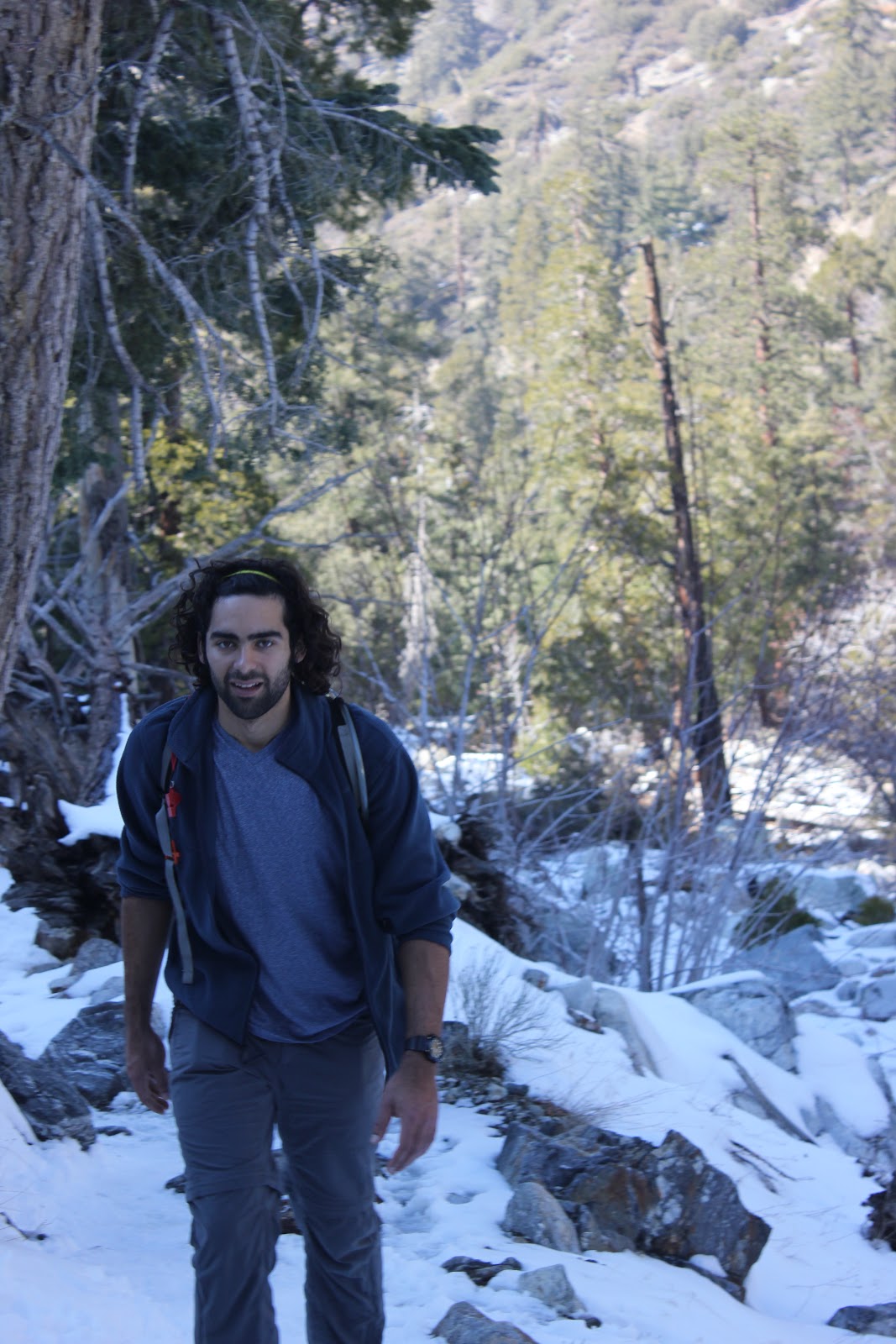
Nicole adjusting to the outdoors
Now, about maybe a mile up the trail, we noticed a ladder. A well put together utility ladder. I don't know who it was intended to be used by, but we did. This climb was very worth it. Just have a little bit more confidence than you do fear, and you should be just fine.


One way ladder!
Once to the top, you're standing under a high voltage power line structure. You know it's high voltage from the nice "hmmmmm" that it gives off. I'm sure it's also giving off some super power giving radiation as well. So try not to sleep under the thing. Unless you want some funky lookin' offspring.

Anywho, we marched on up the narrow clear cut trail. It was fairly steep and full of loose dirt so watch your step. Keep climbing up and you'll reach the large trail again. You'll emerge from the climb looking up at a bridge. It's a pretty cool sight.

ZAP! ZAP!
Climb up there for ShortCut #2
We got a little curious and ventured up to the base of the bridge. Well almost the base of the bridge. Seeing the most direct path up this mountain, we took it. This was shortcut #2. We scrambled up the little dirt path until we reached a thin yellow utility rope that was tied to a steel pipe jutting from the ground. I don't know why I trusted this rope that could of been frayed up top but hey it worked. We pulled ourselves directly under the bridge.


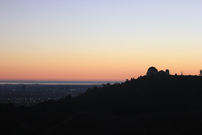
What a view. Immediately we understood the crowds that would come through to take pictures of the panoramic views. Amazing. You could see Los Angeles, Santa Monica, the Pacific Ocean and onward. What a perfect Sunset.


We stuck around for a while, just admiring our beautiful city. It always looks better when looking in.


Took some pics, chit chatted with the fellow hikers, and hiked back down in the dark. If you're careful, you can easily go back through the two shortcuts we took. Just mind your footing, and they won't have to name the trail after you!


This is a fairly easy trail with some exploring between turns. Half a liter of water should do, one liter should be more than enough. So bring it!


Obligatory Handstand Pic
See yah guys out there!
JoshW